Mapping Mount Auburn – Then and Now
 In 1831, civil engineer and surveyor Alexander Wadsworth (1806–1898) used the tools of his trade—a compass and a 66-foot chain of 100 swiveled links—to survey the land comprising the first 72 acres of Mount Auburn Cemetery.

Alexander Wadsworth
Wadsworth’s Plan of Mount Auburn, published in November 1831, is a work of both art and science. It locates the first 200 proposed cemetery lots as well as the seven hills of Mount Auburn, numerous water bodies with islands, new and proposed roads and paths, and Consecration Dell where, one month prior to the plan’s publication, 2,000 people attended the opening of the new burial ground.
Wadsworth, a first cousin of poet Henry Wadsworth Longfellow, was just 25 when he collaborated with Alexander Dearborn and Cemetery co-founder Jacob Bigelow to lay out America’s first landscape cemetery. He would go on to participate in numerous projects in Boston and its suburbs, including the historic districts of Webster Park in Newton and Washington Square in Lowell; and picturesque cemeteries in Salem and Malden.
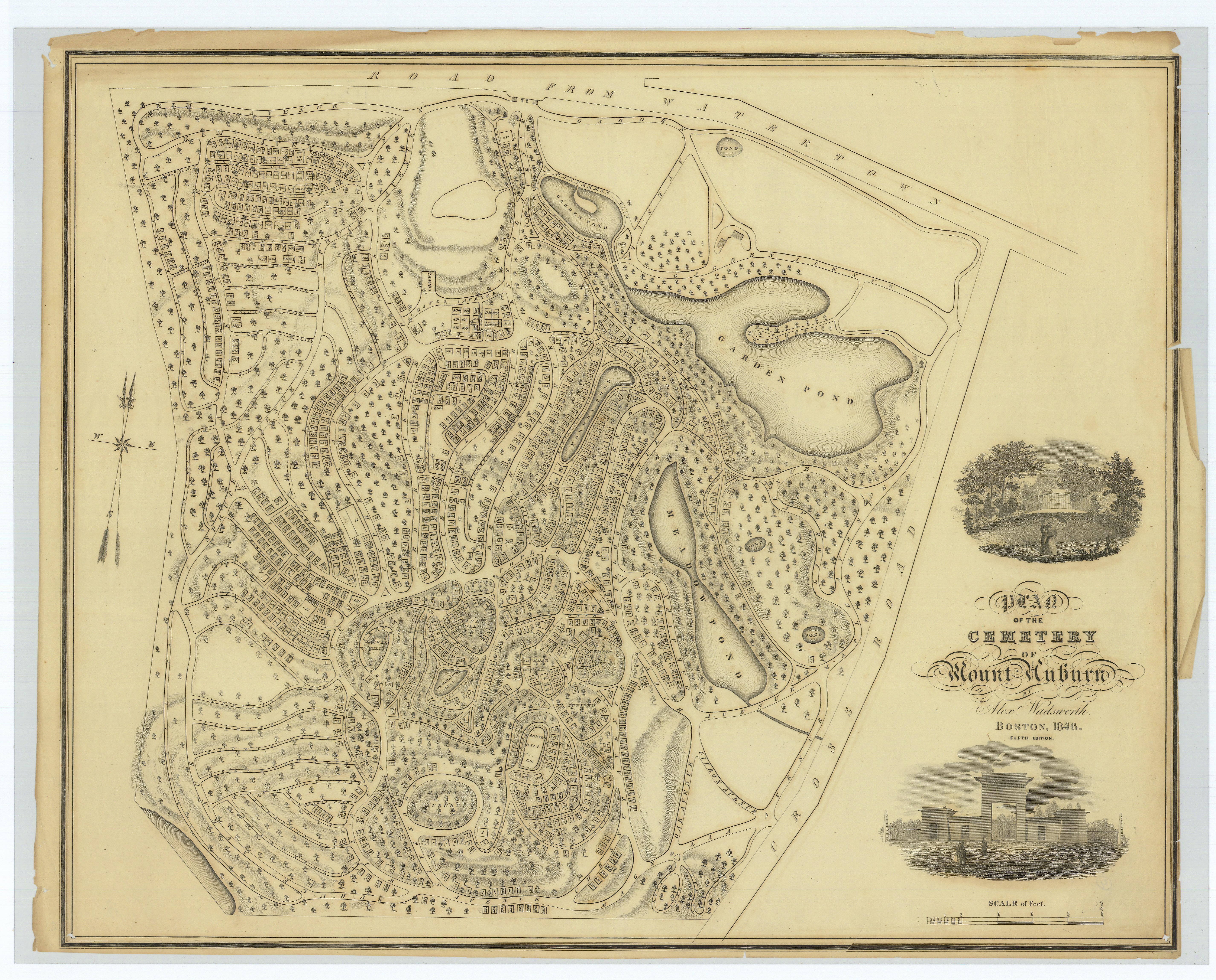
Wadsworth’s Plan of Mount Auburn dated 1846 shows a ‘Scale of Feet.’ In this plan, Wadsworth’s fifth, more than 1200 numbered lots are laid out.
Surveying technology changed little over the course of Wadsworth’s long life but has progressed considerably since then. Today, surveying and navigation programs use satellites to generate maps and way-finding aids for everyone from military intelligence to city drivers.
-
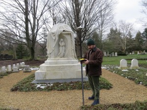
- Plant Records Manager Steve Jackson (sporting mutton chops not unlike Wadsworth’s) works with the Trimble GEO 7x Global Positioning System (GPS) near the Binney monument on Heath Path.

-
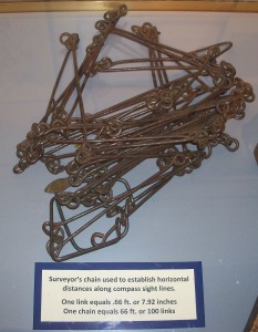
- Meanwhile, Wadsworth would have worked with tools like this chain of swiveled links. By Roseohioresident (Own work) [Public domain], via Wikimedia Commons

Mount Auburn recently acquired a Trimble GEO 7x Global Positioning System (GPS), funded by a generous grant from the Stanley Smith Horticultural Trust, to assist with more accurate mapping of plants. It now takes just 30 seconds to lock a geographic locality into the handheld unit; the data is then integrated into Mount Auburn’s mapping systems.
As an engineer and life-long learner, Wadsworth would have delighted in the new technology. Truthfully, though, today’s computer-generated maps (like below) aren’t nearly as beautiful as his artistic creation of 1831.
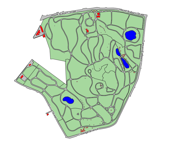
Draft of new map that will be available soon (initially in view-only mode even on mobile devices) for searching lots numbers and residents buried at Mount Auburn.
Leave a Reply